Heavy Snow Begins To Pound Lansing
The entire Lansing area remains under a Winter Storm Warning until 4:00pm Thursday. as of midday Wednesday, wet heavy snow has begun falling across the region and has already led to a few accidents on local surface roads. Traffic on the freeways around Lansing are well below posted speeds.
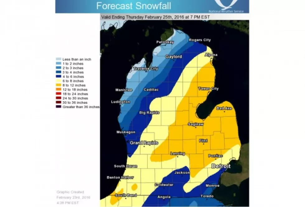
At noon, The National Weather Service updated their storm forecast. One big change is that they expect our precipitation to remain all snow through Thursday afternoon, when originally there was a call for a rain/snow mix for a portion of today. This has upped our expected storm totals to 8 to 12 inches. In Lansing, more specifically, the forecast calls for "around 6 inches" this afternoon, "around 5 inches" overnight, and "around 2 inches" Thursday before it all comes to an end. That's right, add it up, and we're looking at the high end of the snowfall estimates...12 or 13 inches.
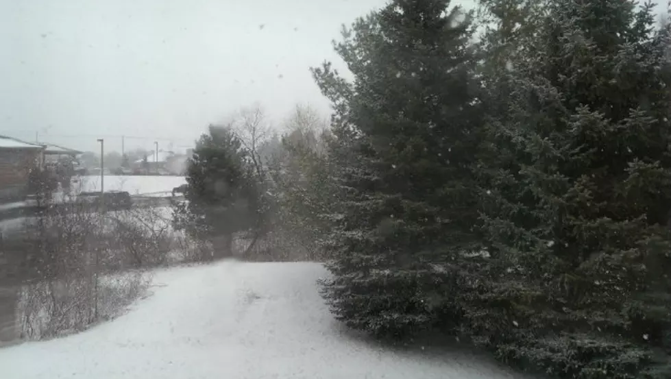
As of 1:30pm Wednesday, visibility is already down to one quarter mile in Lansing, as illustrated in the picture above. Strong northerly winds are expected to pick up this afternoon, evening, and overnight, causing an ever bigger decrease in visibility. Wind gusts of around 40 MPH are expected to cause blowing and drifting of the snowfall. Because of the heavy nature of the snow, meteorologists are expecting some downed trees and limbs, power lines, and power outages. NWS also warns that the heavy snow will likely delay road crews and their efforts to clear roadways, especially secondary and rural roads.
More From 94.9 WMMQ