New Hi-Res Satellite Imagery Shows Lakes Erie, St. Clair From Outer Space
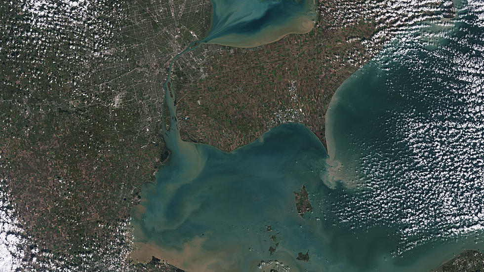
According to NASA's description, this is a hi-resolution images from outer space of Lake Erie and Lake St. Clair. You can see the sediments swirl in Lake Erie and Lake St. Clair. "The photograph taken from Landsat 9 image of both Detroit, Michigan, and Windsor, Ontario, from Oct. 31, 2021. The Great Lakes serve as sources of freshwater, recreational activity, transport, and habitat for the upper-midwestern US, and water quality remains a high priority."

The NASA/USGS description goes on to say that,
"in warmer months, Landsat 9 observes swirls of green algae which can become harmful algal blooms. Landsat 9 will be able to help scientists and resource managers identify those blooms early, identifying areas to test further." - NASA/USGS
Government research work through both NASA and the United States Geological Survey shows the importance of these images and associated data, even as at the same time, much of NASA's better known space missions have become much less high profile over past few years.
The latest of satellites is Landsat 9, which was launched in late September of 2021, and is already producing imagery. And in NASA's words, here's why these images are critical. They provide a preview for people on how to "manage vital natural resources and understand the impacts of climate change, adding to Landsat’s unparalleled data record that spans nearly 50 years of space-based Earth observation."
Having fifty years of images gives these scientists a wealth of data to compare. Currently, with Landsat 9, NASA is putting all the equipment on the satellite though its paces, and once it's officially operational, imagery will be available to the public beginning next year.


